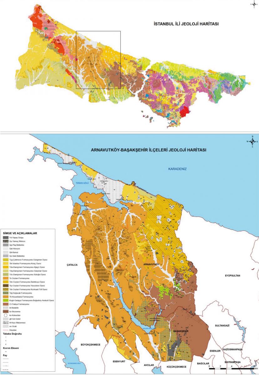


Arnavutköy is located on the Çatalca Peninsula. Çatalca Peninsula is physically separated by streams and has hills in some places. Having an average height of 150-200 meters, these hills exhibit a plateau feature. The surface shapes of Arnavutköy consist of undulating plains, small hills, valleys, lakes, dams, ponds, mines, agricultural areas, woodlands and maquis shrublands. The territory of the district consists of hilly and undulating plains in the northern and eastern regions, and slightly undulating plains in the southern and western regions. In the north-east of the district, dozens of ponds formed by old stone, sand and mines are located in the area stretching to the Black Sea. Lake Terkos, located in the district, lies parallel to the Black Sea coastline on the edge of a hilly terrain at an altitude of 100-150 m. There are undulating plains around the lake and high sloping hills, the heights of which gradually increase towards the west. In general, a less rugged morphology is observed around the lake. The forested area and coastline between Terkos and Kasatura are a natural habitat of ecological and biological importance. Terkos Lake and its surroundings are an important bird nest throughout the country. In addition, Terkos forests are one of the three forest areas in Istanbul that meet international criteria (Istanbul Provincial Environmental Layout Plan, p. 116). The area of 5790 hectares around Lake Terkos is also a protected forest are (Istanbul Provincial Environmental Layout Plan, p. 127). Lake Terkos is also one of the three wetlands in Istanbul.
3 of the four ecological corridors in Istanbul travel through the Arnavutköy district from north to south. These are the Büyükçekmece-Terkos, Küçükçekmece-Terkos and Golden Horn-Terkos corridors. These function as Istanbul's wind pipes. On the other hand, biological diversity should reach the city by ensuring the functional connection of green areas and forests through ecological corridors. The number of urban structures should be kept low where these corridors pass, and it is necessary to ensure urban air circulation using urban design methods along with the designated open and green areas. In the north of the district, the coastal line between Lake Terkos and the Black Sea shows a coastal type with partly steep cliffs and partly beaches. Looking at the main materials forming the soils around the lake, one can see a structure inclined to erosion.
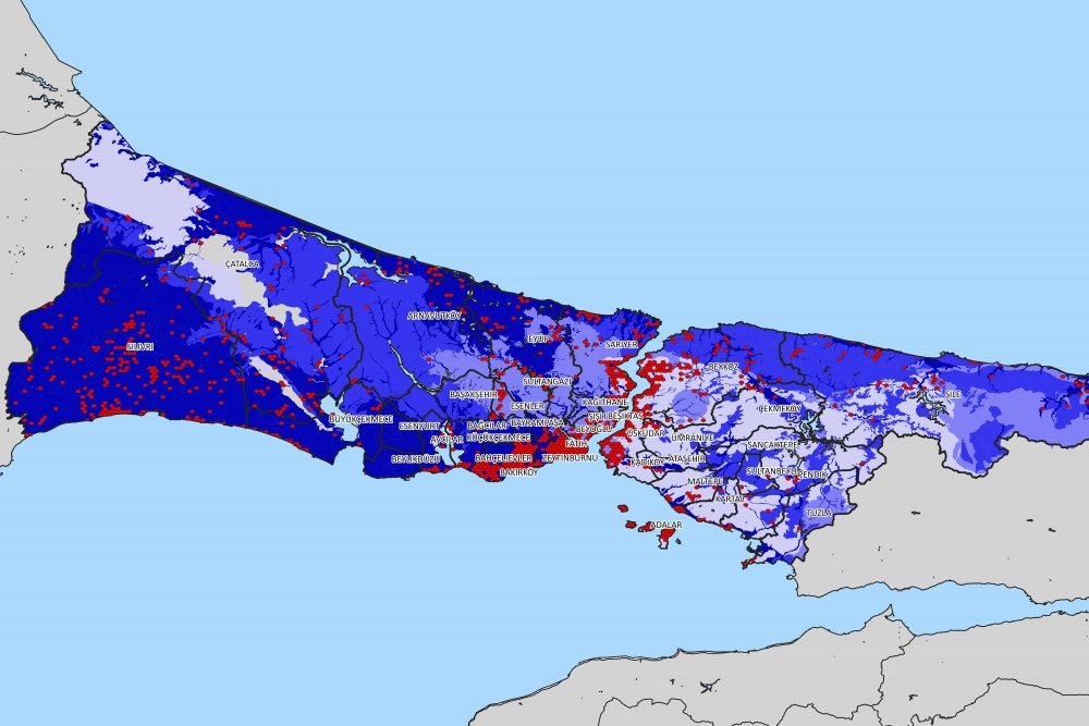
Erosion is studied under two headings: water and wind erosion. The dominant form of erosion in our country and in Istanbul is water erosion. The areas of mild erosion in the lands of Istanbul province are 205.147 ha. It is an area constituting the majority in the country with 49%. These areas are mainly clustered in the northern parts of the Anatolian Side and the north-northwestern parts of the European Side. The areas of moderate erosion are 158,491 ha. and they account for 38% of Istanbul and 11% of the lands are under the influence of severe erosion. There are very few (2%) areas exposed to very severe erosion. The areas with very severe erosion are the coastal areas of Arnavutköy District along the Black Sea coast, as seen on Map 9.
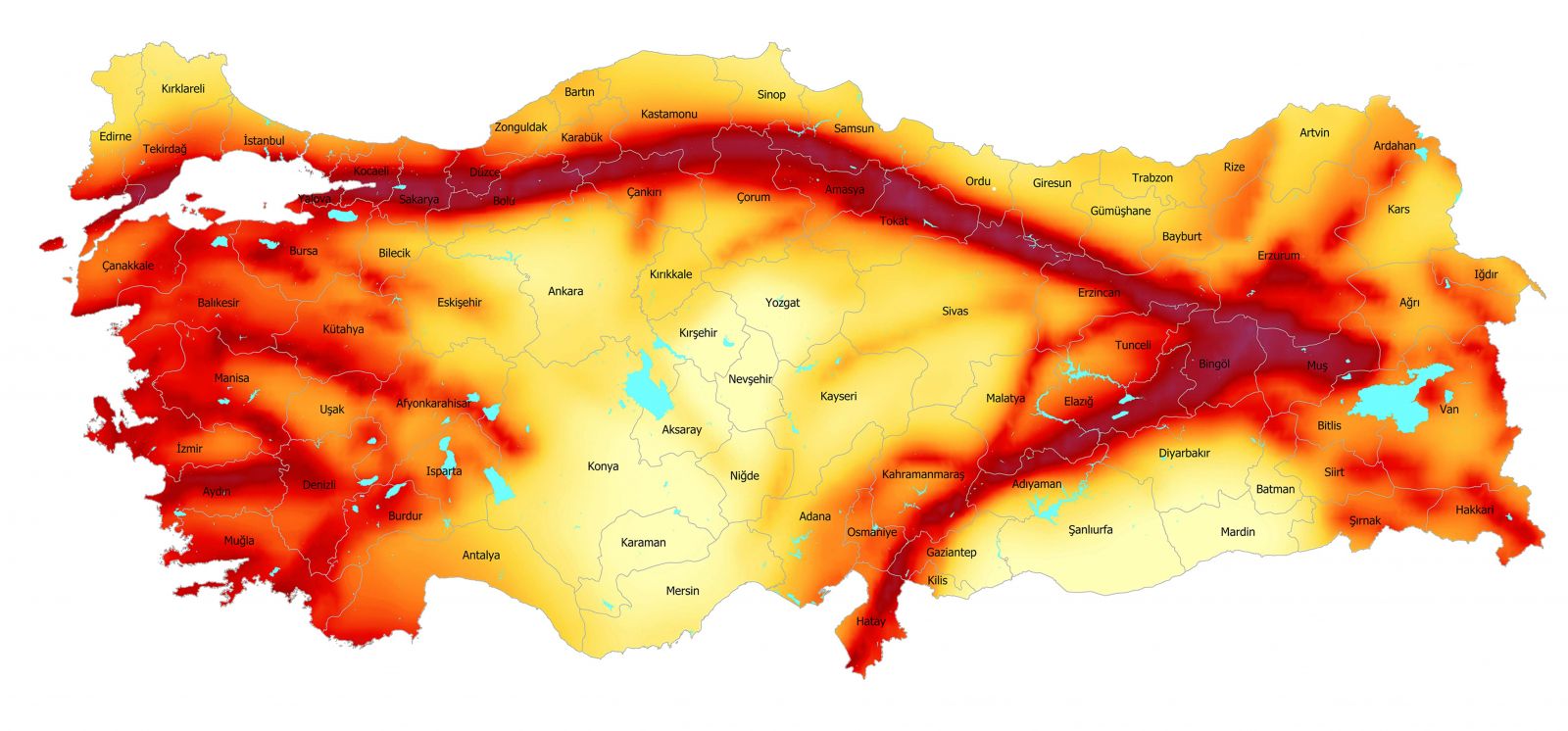
Entering into force with the decision no. 96/8109 of the Council of Ministers on April 18, 1996, the Earthquake Zones of Turkey shows the earthquake evaluation of Istanbul and its surroundings. Accordingly, the vast majority of the Arnavutköy District is a 3rd degree (low risk) earthquake zone according to the general categorization based on geological and geophysical principles.
Earthquake risk maps show the impact of earthquakes waves only by regions. An important aspect to note is the fact that the earthquake magnitude increases depending on the structure of the local soil. In other words, two different places located in the same region will feel the earthquake at different intensities according to their soil structure. From this point of view, it can be said that the stream beds and the slopes with landslide potential are especially risky areas in Arnavutköy.


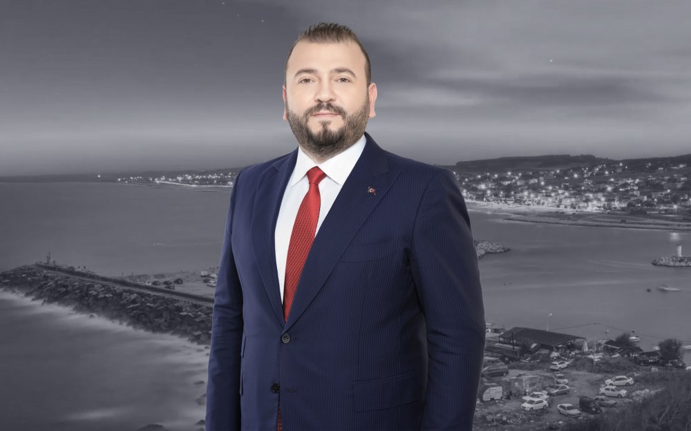
Mustafa CANDAROĞLU, originally from Cide, Kastamonu, was born on December 5, 1984, in Arnavutköy, Istanbul.
He graduated from Boğazköy Primary School in 1996, Asfa Middle School in 1999, and Sultan Fatih Anatolian High School in 2002. Completing his undergraduate education at the Faculty of Fine Arts of the International Cyprus University, Candaroğlu graduated in Interior Architecture in 2008. He completed his military service as a Short-Term Soldier at the Kayseri Regional Gendarmerie Command. After military service, Candaroğlu completed his master's education in Educational Institutions Management at Ibn Haldun University, and volunteered in various NGOs.
He served as Deputy President of the Arnavutköy Kastamonulular Association, and was a member of the boards of Arnavutköy Sports Club and Arnavutköy Beşiktaşlılar Association.
Being involved in politics throughout his education and social life, Candaroğlu served on the UNIAK Board of Directors in 2004 and actively entered politics in the Arnavutköy Belde Youth Branch in 2008. In Arnavutköy, which became a district in 2009, he held positions in District Congresses as follows: • 2009 as an Alternate Board Member of the District Primary Committee, • 2011 as a Board Member of the District Primary Committee, • 2013 as a Board Member of the District Primary Committee responsible for R&D and Local Governments. • Elected as District President in the 2018 and 2020 Congresses, Candaroğlu continues to serve as the AK Party Arnavutköy District President.
Born, raised, and currently living in Arnavutköy, Candaroğlu always finds happiness in serving in the AK Party, which practices politics based on the principle of "We love the created for the sake of the creator." After working for a long time as an Interior Architect in a family company, he continues to serve as the Chairman of the Board of Directors of Arnavutköy Bilgi Kalem College, which he founded in 2019.
Mustafa CANDAROĞLU, married and father of 3 children, speaks English proficiently.
Content is updating