Although the history of Arnavutköy is said to date back to the Trikos Castle, an ancient settlement (which is not mentioned much in historical archives) is found to the east of the Sazlıbosna-Kayabaşı road in the area of Filipos Desertion (Filipos Farm). In this context, the oldest settlement within the borders of Arnavutköy is the ancient city of Filipos, called the Filipos Desertion (Filipos Farm) in east of the Sazlıbosna-Kayabaşı road.
The history of the present-day Durusu (Terkos) district also dates back to 1000 years ago. The district of Çatalca, where the Terkos Lake is located, and its surroundings were an ancient Thracian settlement during the Eastern Roman Empire. Since Terkos and its surroundings have been covered with large forest areas since ancient times, it is known that they were used as an important hunting center during the rules of the Eastern Roman and Ottoman Empires. Built during the Eastern Roman period on the edge of Durusu Lake, Trikos Castle was one of the front defense lines of Istanbul. The castle fell into the hands of the Genoese, and eventually conquered by Mehmed II. (the Conqueror) in 1452.
Arnavutköy had one of the main water supply pipelines to Istanbul during the late Roman period. It is believed that Roman Emperor Constantine started the construction of the water supply line, and it was later continued and completed by the subsequent rulers. The water supply line is considered to have started from Kırklareli's Vize district and it is thought to have had a length of 242 km. The water supply line passed south of Lake Terkos via Vize, Saray, Istranca, Aydınlar, Gümüşpınar, Çiftlikköy, Kalfaköy and Dağyenice and reached Tayakadın. It continued from the right bank of Alibeyköy Creek, passing Cebeciköy and Küçükköy and entering the city about 200 m south of Edirnekapı. There are about 40 aqueducts on the water supply line that are still half ruined or only the foundations remain. The water supply system had been used continuously for about 1000 years; however it was probably abandoned in the XII century due to the damage caused by earthquakes.
During its rule, the Ottomans often encountered problems in Lake Terkos meeting the water needs of Istanbul. The weirs of the Terkos were cloudy and had a foul smell, causing enteritis among people. Later, its waters were cleaned and maintenance and repair were provided for the weirs. The waterways were replaced with iron pipes and to overcome the problem. In addition, the Medical School run certain tests and found infectious and microbial diseases in Terkos water. Thus, the public was informed not to drink and use it without filtering and boiling. In addition to these measures, a military unit was assigned to prevent foreign substances from entering the Terkos water.
Considering that the main reason for the water shortage that Istanbul suffered from was due to the deterioration of waterways, the authorities were convinced that raising the embankments and increasing the waters would not provide the expected benefit unless their maintenance and repair were made. Thus, it was decided to establish a valve and pump station. A tramline was constructed between Terkos and Karaburun to facilitate the transportation of the tools and instruments needed for the construction of the waterway, and a set and pier were constructed in Karaburun, demonstrating the extensive effort to solve Istanbul's water problem by Terkos' waters.
In order to meet the water needs of Istanbul, an elevation center and a pumping station were built on the shore of Lake Terkos between 1855 and 1857; the Terkos Water Company purified the supplied water and started supply the water to the city. These facilities were converted into a "Water Museum" by the Istanbul Water and Sewerage Administration.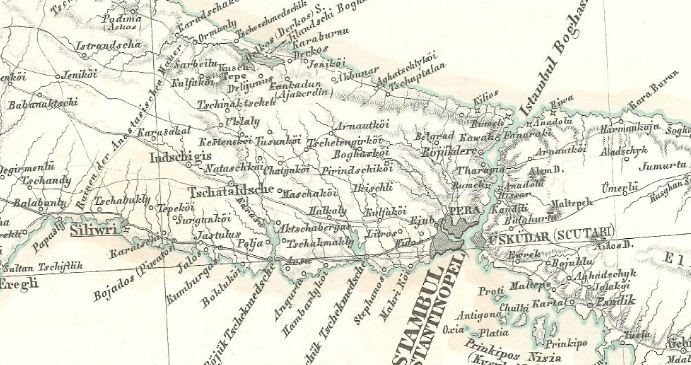
Terkos and its environs met the water needs of Istanbul during the Ottoman period, as well as being the supply center for the timber needed for constructing the navy on the Imperial Arsenal. A navy was built with the timbers supplied from the regions of Terkos, Çatalca, Silivri, Büyükçekmece, Midye, Saray, Vize and Pınarhisarı.
The name Arnavutköy (Arnautköi) appears in the Ottoman archives and maps of the time since the middle of the 19th century. It is believed that an Albanian peasant who lived in this region in ancient times was the namesake father of Arnavutköy. As a matter of fact, the region had been located in the route to Edirne and therefore to Europe since its earliest periods. Due to the fact that it was located on the main road and an Albanian lived here, those who passed by this route called this place the Albanian's Village over time. This name changed over time first to "Arnavutköyü (the Village of the Albanian)" and then to "Arnavutköy".
There have been three major changes in the population of Arnavutköy and its surroundings in the last century. The first of these took place with the emigration from Bulgaria, Kosovo and Macedonia during the Balkan Wars. As a matter of fact, migrants and refugees from Demirhisar, Toyran, Thessaloniki, Tikveş and Priştine had been resettled in the villages of Terkos, Tayakadin and Imrahor after the Balkan War.
The second major change in the population of the region occurred at the end of the Population Exchange Treaty signed between Turkey and Greece in 1923. Along with the exchange, the Turks in the Greek province of Drama were resettled in Arnavutköy and the surrounding villages. After the exchange, the number of households in Arnavutköy reached 350.
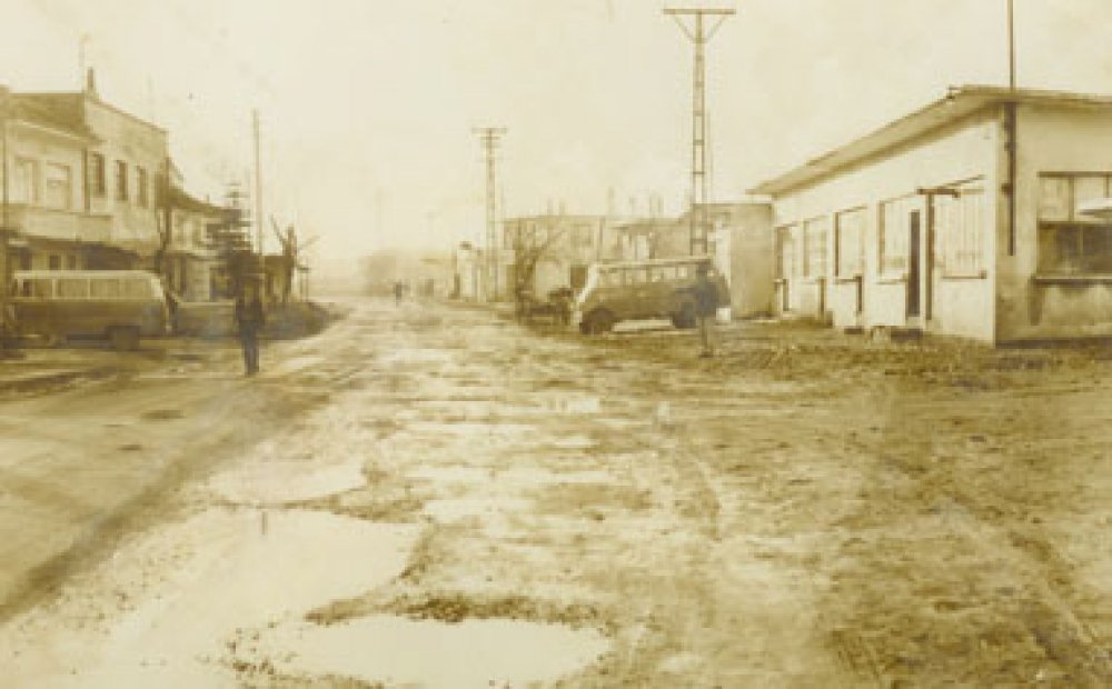
The third major change occurred in the process after Arnavutköy became a town. Over the years, Arnavutköy has been affected by the domestic migration moves throughout Turkey and has become an increasingly large center.
Arnavutköy was connected to Çatalca District during the Ottoman period and then it was annexed to Çatalca Town. During the Republican period, it was first a village connected to Eyüp District, and when Gaziosmanpaşa became a district in 1963, it was annexed to this district, and in 1987, it gained the status of a town connected to Gaziosmanpaşa District. Hadımköy and Durusu within the borders of today's Arnavutköy gained the status of towns in 1969 and 1989, respectively, while Boğazköy, Bolluca, Haraççı and Taşoluk became towns in 1994.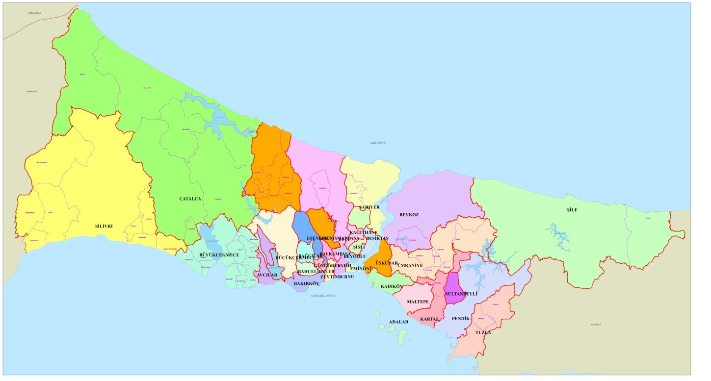
The towns of Boğazköy, Bolluca, Durusu, Haraççı, Hadımköy and Taşoluk were annexed to Arnavutköy Municipality by "the Law No. 5747 on the Establishment of Districts within the Boundaries of the Metropolitan Municipality and Amendments to Some Laws". In addition, Bahşayış Neighborhood annexed to Çatalca and 8 forest villages within the boundaries of Çatalca and Gaziosmanpaşa as well as the north of Sazlıdere Dam Lake of the Şamlar Village belonging to Küçükçekmece District were annexed to Arnavutköy
The newly established Arnavutköy District became one of the 39 districts of Istanbul, while the entire territory of the district is now recognized as the service area of the Arnavutköy District Municipality. While Arnavutköy had been part of Gaziosmanpaşa for about 45 years, it thus became a separate district. With a total area of 506.52 km², the district is now the fourth largest district of Istanbul.
After the Law No. 5747 entered into force, the legal entity status of all other villages, with the exception of forest villages located within the boundaries of Arnavutkoy District, was abolished and they were turned into a neighborhood. The villages that have preserved the status of forest village are: Baklalı, Balabanburun, Boyalık, Hacımaşlı, Karaburun, Tayakadın, Yassıören and Yeniköy.
Nakkaş (46,78 km²) and Bahşayış (9,46 km²) neighborhoods were annexed to Arnavutköy with law no. 5747, and then to the Province of Çatalca with the "Law No. 6360 on Establishment of Metropolitan Municipalities and 26 Districts in Thirteen Provinces and the Amendment of Certain Laws and Decrees having the Force of Law". Thus, the area of the district decreased by 56.24 km² and became 450.28 km². Despite this, Arnavutköy has maintained its position as the fourth largest district of Istanbul.

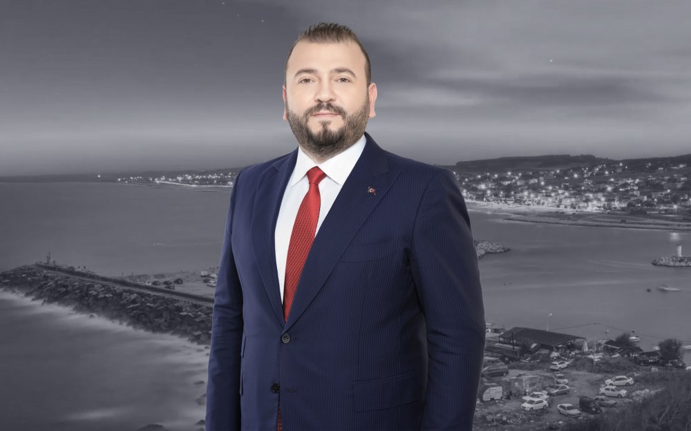
Mustafa CANDAROĞLU, originally from Cide, Kastamonu, was born on December 5, 1984, in Arnavutköy, Istanbul.
He graduated from Boğazköy Primary School in 1996, Asfa Middle School in 1999, and Sultan Fatih Anatolian High School in 2002. Completing his undergraduate education at the Faculty of Fine Arts of the International Cyprus University, Candaroğlu graduated in Interior Architecture in 2008. He completed his military service as a Short-Term Soldier at the Kayseri Regional Gendarmerie Command. After military service, Candaroğlu completed his master's education in Educational Institutions Management at Ibn Haldun University, and volunteered in various NGOs.
He served as Deputy President of the Arnavutköy Kastamonulular Association, and was a member of the boards of Arnavutköy Sports Club and Arnavutköy Beşiktaşlılar Association.
Being involved in politics throughout his education and social life, Candaroğlu served on the UNIAK Board of Directors in 2004 and actively entered politics in the Arnavutköy Belde Youth Branch in 2008. In Arnavutköy, which became a district in 2009, he held positions in District Congresses as follows: • 2009 as an Alternate Board Member of the District Primary Committee, • 2011 as a Board Member of the District Primary Committee, • 2013 as a Board Member of the District Primary Committee responsible for R&D and Local Governments. • Elected as District President in the 2018 and 2020 Congresses, Candaroğlu continues to serve as the AK Party Arnavutköy District President.
Born, raised, and currently living in Arnavutköy, Candaroğlu always finds happiness in serving in the AK Party, which practices politics based on the principle of "We love the created for the sake of the creator." After working for a long time as an Interior Architect in a family company, he continues to serve as the Chairman of the Board of Directors of Arnavutköy Bilgi Kalem College, which he founded in 2019.
Mustafa CANDAROĞLU, married and father of 3 children, speaks English proficiently.
Content is updating